Xi’an, situated in the central part of the Guanzhong Basin in the Yellow River Valley, is flanked by the Wei River to the north and the Qinling Mountains to the south. Bordered by the Ling River and the Ba Mountains to the east, it connects with Hua County in Weinan City, Shangzhou District in Shangluo City, and Luonan County. To the west, it is bounded by the Taibai Mountains and the Qinghua Loess Plateau, adjoining Meixian and Taibai counties. Spanning approximately 204 kilometers east to west and 116 kilometers north to south, Xi’an covers a total area of 10,108 square kilometers.
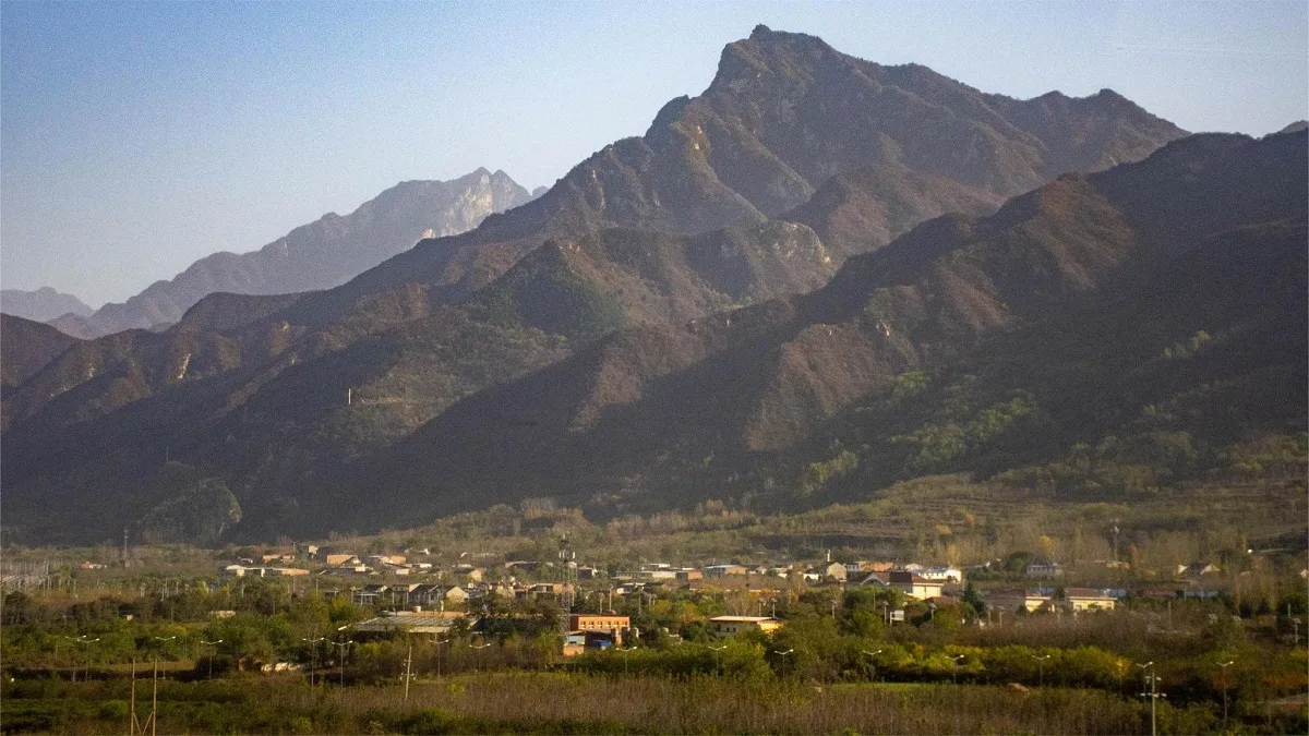
Geologically, Xi’an encompasses both the Qinling tectonic zone and the North China Craton. Approximately 130 million years ago, during the Yanshan movement, the Qinling fault, spanning across the region, was formed. Since about 3 million years ago in the late Tertiary period, the southern part of the Qinling fault, belonging to the Qinling tectonic zone, has experienced vigorous new tectonic movements, resulting in intense elevation changes, shaping the Qinling Mountains. Meanwhile, to the north of the fault lies the Wei River basin, part of the North China Craton, which continued to subside. Under the combined effects of wind-blown loess deposition and Wei River alluvial action, the Wei River Plain gradually formed. Xi’an boasts the largest disparity in elevation among Chinese cities, with the towering Qinling Mountains in the south and the expansive Wei River Plain in the north, defining its topography. The main ridge of the Qinling Mountains ranges from 2,000 to 2,800 meters above sea level, with the peak of Mount Taibai, at the southwestern end, towering at 3,867 meters, making it the highest peak in central China. The Wei River Plain ranges from 400 to 700 meters above sea level, with the lowest point of the Wei River bed in the northeast at an elevation of 345 meters. The urban area of Xi’an is situated on the second terrace of the Wei River Plain.
Xi’an experiences a temperate continental monsoon climate in the subtropical zone, characterized by distinct four seasons with cold, dry winters, warm, windy springs, hot, rainy summers, and cool, rainy autumns. The average annual temperature ranges from 13.0°C to 13.7°C, with average temperatures in January ranging from -1.2°C to 0.0°C and in July ranging from 26.3°C to 26.6°C. The extreme minimum temperature recorded was -21.2°C (in Lantian on December 28, 1991), while the extreme maximum temperature recorded was 43.4°C (in Chang’an on June 19, 1966). The annual precipitation ranges from 522.4 to 719.5 millimeters, increasing from north to south. July and September are the two peak months of precipitation. The annual sunshine duration ranges from 1,646.1 to 2,114.9 hours.