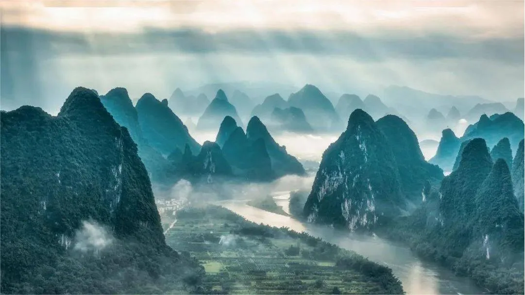
The Lijiang River in Guilin (桂林漓江) is renowned as one of the world’s largest and most picturesque karst landscapes, often referred to as the “hundred-mile Lijiang, hundred-mile art gallery.” The back of the 20 yuan banknote features a section of this stunning river scenery. The Lijiang River showcases different charms in varying weather conditions: clear reflections of green peaks on sunny days, misty mountains on cloudy days, and dreamlike rain scenes.
The name of Lijiang River derives from the Lingqu Canal, an ancient engineering marvel, which splits into the South Canal and North Canal. Water originating from Mao’er Mountain flows through the Lingqu Canal and is divided by the Tianping Dam. Seven parts of the water flow into the North Canal, joining the Xiangjiang River, while three parts flow into the South Canal, merging with the Lijiang River. The names “Xiangjiang” and “Lijiang” are derived from the separation (相离, Xiang Li) at the Tianping Dam, with “Xiang” representing the northward flow and “Li” the southward flow.
Visitors typically explore the Lijiang River through three main ways: by boat, bamboo raft, or on foot. Boat tours are categorized into essence tours, Yangshuo water tours, and city water tours.
Table of Contents
- Basic Information
- Location and Transportation
- Highlights of Lijiang River
- Chuanshan (穿山)
- Wangfu Stone (望夫石)
- Longtou Mountain (龙头山)
- Luoshan Mountain (螺狮山)
- Xingping (兴坪)
- Yellow Cloth Reflection (黄布倒影)
- Nine Horses Fresco Hill (九马画山)
- Caoping (草坪)
- Yangdi Scenic Area (杨堤风光)
- Langshi Scenery (浪石风光)
- Xialong Scenery (下龙风光)
- Banbian Ferry (半边渡)
- Guanyan (冠岩)
- Huangniu Gorge (黄牛峡)
- Daxu Ancient Town (大圩古镇)
- Tower Hill (塔山)
- Vlog about Lijiang River
- Local Delicacies
- Other Iconic Attractions in Guilin
Basic Information
| Estimated Length of Tour | Half a day |
| Ticket Price | Depends on the specific section and boat type |
| Opening Hours | 24 hours a day throughout the year |
| Telephone Number | 0086-0773-2881088 0086-0773-8287688 |
Lijiang River Ticket Information
The route from the Guilin Mopan Mountain Pier or Bamboo River Pier to Yangshuo is the essence of the Lijiang River cruise area. Key attractions along the way include: Guanyan, Tongzi Worshiping Guan Yin, Nine Horses Fresco Hill, and Yellow Cloth Reflection. The tour lasts approximately 4.5 hours.
The Yangshuo Water Cruise route is the downstream section of Yangshuo, starting from the Water East Gate Pier in Yangshuo County and returning to Pu Yi. The route passes through Fuli Town, allowing passengers to enjoy the downstream scenery of Yangshuo. Key attractions along the way include: Bilian Peak, Xiucai Exam List, and Shutong Mountain. The total tour duration is approximately 3 hours.
Bamboo River Pier (竹江码头) – Yangshuo (阳朔)
| Season | Full Ticket Price | Half Ticket Price | Boat Type | Lunch |
|---|---|---|---|---|
| Peak Season | 270 RMB | 135 RMB | Air-Conditioned Boat | Additional 35 RMB/person for lunch |
| Off-Season | 240 RMB | 120 RMB | Air-Conditioned Boat | Additional 35 RMB/person for lunch |
| Peak Season | 450 RMB | 225 RMB | Luxury Boat | Includes Chinese Buffet |
| Off-Season | 380 RMB | 190 RMB | Luxury Boat | Includes Chinese Buffet |
Mopan Mountain Pier (磨盘山码头) – Yangshuo (阳朔)
| Season | Full Ticket Price | Half Ticket Price | Boat Type | Lunch |
|---|---|---|---|---|
| Peak Season | 210 RMB | 105 RMB | Standard Air-Conditioned Boat | Includes Chinese Economic Meal |
| Off-Season | 190 RMB | 95 RMB | Standard Air-Conditioned Boat | Includes Chinese Economic Meal |
Yangshuo (阳朔) – Puyi (普益): 160 RMB
Season Definitions:
- Peak Season: April to November and Spring Festival holiday
- Off-Season: January, February, March, December
Location and Transportation
The Lijiang River Scenic Area is located in Xing’an County, northeast of Guilin City, Guangxi Zhuang Autonomous Region. Its geographical coordinates are 25°9’35” N, 110°26’18” E.
To get there, you can take the dedicated bus line from Guilin Railway Station to Mopan Mountain Pier. This line operates along Route 9 and makes stops at various points. Buses run four times daily, departing from Guilin Railway Station at 7:20, 8:20, 9:20, and 18:00, with departures from Mopan Mountain Pier at 8:20, 9:20, 10:20, and 17:00.
Highlights of Lijiang River
Chuanshan (穿山)

Chuanshan is located on the eastern bank of Xiao Dongjiang, southeast of Guilin city center in Qixing District, about 3.5 kilometers from the city center. It has an elevation of 224 meters and covers an area of 25.25 hectares. The mountain consists of five peaks, resembling a majestic rooster with the west and east peaks forming the head and tail, the north and south peaks as wings, and the central peak as the back. The moon-shaped cave on the western peak represents the rooster’s eye. Chuanshan, along with Guishan (Turtle Mountain) across the river, vividly resembles two roosters fighting, earning it the name “Douji Mountain” (Fighting Rooster Mountain).
Wangfu Stone (望夫石)

Wangfu Stone is situated on the west bank of the Lijiang River, in front of Doumi Beach, approximately 37 kilometers from Guilin. The mountain’s summit features an immortal-like stone figure facing north, while midway up the mountain is a stone resembling a woman carrying a baby on her back, gazing into the distance. This stone is named Wangfu Mountain, also known as Wangfu Stone, symbolizing a woman waiting for her husband.
Longtou Mountain (龙头山)

Longtou Mountain serves as a natural barrier south of Dishui Cave, with its main peak standing at an elevation of 440 meters, making it the third highest peak in Shaoshan. The “Second Revision of the Mao Family Genealogy of Shaoshan” describes Longtou Mountain as rising steeply from the ground, standing tall among thousands of peaks and valleys. It has fertile land and sweet springs. According to legend, a giant dragon from the North Sea Dragon King’s palace submerged its tail into Dongting Lake and raised its head in Shaoshan, forming the Longtou Mountain of Dishui Cave.
Luoshan Mountain (螺狮山)

Luoshan Mountain, located on the west bank of the Lijiang River, features a spiral rock formation that winds from the base to the summit, resembling a giant green snail. The poet Guo Moruo described it as “the green snail bearing rain pressing down on the long river.” At the foot of the mountain lies Luosiyan, a bright and open river mouth. During the Ming Dynasty, Tengjiao Temple was built here, comprising the Hall of Three Treasures and the Kuixing Tower, and it was renovated during the Qing Dynasty. In front of the cave is Xianglu Stone, which closely resembles an incense burner. Inside the cave are three snail-shaped stones, one white as snow, one green as jade, and one black as lacquer. The cave also features cliffside inscriptions that document the origin of the cave and the surrounding scenery.
Xingping (兴坪)

Xingping Town is located in the northeast part of Yangshuo County, Guilin, in the Guangxi Zhuang Autonomous Region, on both banks of the upper reaches of the Lijiang River, about 25 kilometers from the county seat. The Lijiang River flows through Xingping, forming an “S”-shaped bend, which is considered the essence of Lijiang River’s scenic beauty. Marshal Ye Jianying wrote a poem about the area, praising its spectacular views. The area is characterized by its dense, picturesque scenery with unique, dangerous, beautiful, and interesting features.
Yellow Cloth Reflection (黄布倒影)

South of Huashan Mountain is a yellow rock several feet wide that looks like a yellow cloth laid flat at the bottom of the river, giving the area the name Yellow Cloth, with the beach named Yellow Cloth Beach. In 2000, the People’s Bank of China issued the fifth series of the renminbi, featuring the Lijiang River scenery on the back of the 20 yuan note, showcasing the reflection of Yellow Cloth.
Nine Horses Fresco Hill (九马画山)

Nine Horses Fresco Hill is located 4 kilometers northwest of Xingping Town. Standing over 400 meters high and 200 meters wide, the mountain features steep, colorful cliffs resembling a giant painted screen. The mountain comprises five peaks, with the stone walls along the river displaying a variety of colors, including green, yellow, and white, creating a vivid and vibrant scene. The patterns on the rock resemble nine horses, giving the mountain its name, Nine Horses Fresco Hill, or simply Fresco Hill.
Caoping (草坪)

Caoping is located 35 kilometers southeast of Guilin city, along the banks of the Lijiang River. It borders Chaotian Township in Lingchuan to the east and Daxu Town to the north, covering an area of 32 square kilometers, with three-quarters consisting of stone mountains. The Lijiang River flows from north to south through this area for a 10-kilometer stretch. The river meanders through a landscape of towering peaks and verdant mountains reflecting in the clear water, creating a picturesque and serene environment.
Yangdi Scenic Area (杨堤风光)

The Yangdi Scenic Area stretches from Guanyan Village in the north to Xingping Scenic Area, covering approximately 18 kilometers of the Lijiang River. This section is known as the golden waterway of the Lijiang River. The banks are lined with dense bamboo forests, forming a continuous green screen that sways among the green mountains, clear waters, waterfalls, and shallow beaches. This creates a peaceful and tranquil environment, highlighting the pristine beauty of the Lijiang River.
Langshi Scenery (浪石风光)

Along the riverbank, there is a series of jagged and overlapping reefs that resemble waves in the ocean, hence the name “Langshi” (Wave Stones). The village by the bank is called Langshi Village. The landscape here features towering peaks on both sides, with narrow and winding waterways. Surrounded by mountains and rivers, one can see the water flowing through the river gorge ahead and sailboats framed by the gorge beside.
Xialong Scenery (下龙风光)

After passing Xialong Village, you encounter Ximo Tianling and Chongtian Peak, which together form the “Sky Pillar Clamping the River.” Chongtian Peak, along with Yuwei Peak and Laoren Zuoji Peak, is collectively known as the “Three Peaks of Xialong.” The scenery in the Xialong area is picturesque, with reflections of peculiar peaks in the water and layers of mountains in the background. When former U.S. President Nixon visited this area, he compared one of the peaks on the right bank to a pyramid.
Banbian Ferry (半边渡)

On the west bank of the Lijiang River, about 43 kilometers from Guilin city, stands Dutou Mountain with an elevation of 400 meters. The steep cliffs intercept the southward-flowing river, creating surging waves. On both sides of the mountain are two villages: Guanyan Village and Taoyuan Village. These villages are separated by high mountains and rely on ferries for transportation. The ferry here only crosses halfway from one side to the other, hence the name “Banbian Ferry” (Halfway Ferry).
Guanyan (冠岩)

Located 29 kilometers south of Guilin city, on the eastern bank of the Lijiang River in Caoping Township, Guanyan is named for its resemblance to an emperor’s golden crown. Guanyan is a massive underground river cave stretching 12 kilometers, originating from Haiyang Mountain east of Guilin. Officially opened to the public in 1995, it features a stunning landscape with competing peaks, clear waters, and beautiful cave formations. At night, visitors can enjoy ethnic song and dance performances, with vibrant folk songs echoing through the gorge.
Huangniu Gorge (黄牛峡)

Huangniu Gorge is located on the west bank of the Lijiang River, south of Mopan Mountain, opposite the green banks across the river, about 30 kilometers from Guilin. The gorge is filled with unique rocks resembling green lotuses, lions, tigers, bats, and herds of yellow cattle, giving it the name Huangniu Gorge. The clear waters of the Lijiang River make a sharp 90-degree turn here, splitting into two streams and crashing against three islets before continuing their journey southward.
Daxu Ancient Town (大圩古镇)

Daxu Ancient Town is located 18 kilometers southeast of Guilin city and 30 kilometers from Lingchuan County. Positioned on the north bank of the Lijiang River, it stretches from west to east along the river. Covering an area of 193.78 square kilometers, Daxu Ancient Town serves as a key water and land transportation hub in northern Guangxi, connecting the north to Hunan and Jiangxi, and the south to Wuzhou and Guangzhou. It is a bustling center for the distribution of agricultural and imported goods in the eastern suburbs of Guilin.
Tower Hill (塔山)

Tower Hill is situated on the east bank of the Lijiang River, on the west side of Xiao Dongjiang, facing Chuanshan across the river. With an elevation of 194 meters and a relative height of 44 meters, it covers an area of 2.75 hectares. Tower Hill and Chuanshan were part of the same mountain body a million years ago. However, due to crustal uplift and a drop in the underground water table, the mountain was cut and separated into individual peaks.
Vlog about Lijiang River
Local Delicacies
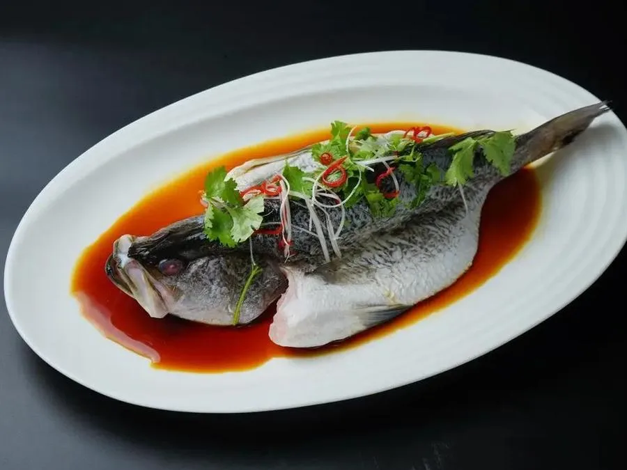
Steamed Lijiang River Mandarin Fish (清蒸漓江桂鱼)

Guilin’s picturesque environment and the clear waters of the Lijiang River contribute to the renowned Lijiang River mandarin fish. Known for its fattiness, tenderness, freshness, and smooth texture, this fish is a local delicacy. The traditional preparation method is steaming, which enhances its natural flavors. The fish is steamed with shredded pork, resulting in a dish with delicate, tender fish meat that is both flavorful and pleasingly smooth.
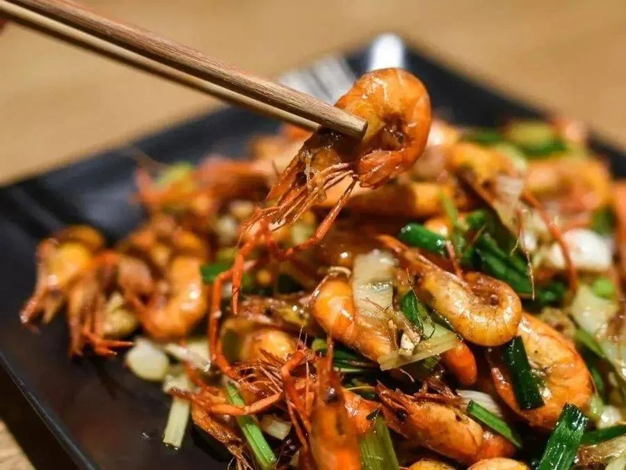
Stir-Fried Lijiang River Shrimp (爆炒漓江虾)

Using fresh river shrimp from the Lijiang River, this dish is stir-fried with a touch of Guilin Sanhua wine. The clear and pure waters of the Lijiang River produce shrimp with a tender and authentic taste. The result is a dish with a vibrant red color, a crispy yet tender texture, and a subtle aroma. The stir-fried shrimp offers a taste of the river’s purity and sweetness, showcasing the local flavor and freshness of the ingredients.


After a few days of rainfall in Guilin, the water level of the Li River rose, and the water became murky. However, the Li River cruises are still operating normally for sightseeing, while the bamboo rafting on the Yulong River has been suspended due to the impact of the weather. Most attractions in Guilin are still unaffected by the rain!
The purpose of my visit to Guilin was to enjoy the beautiful mountains and rivers. I think it’s a must to take a cruise on the Li River, as it passes through the highlights of this scenic area. This way, you won’t have to spend time going to various places for photo opportunities. Locals recommend visiting in March or April. In early April, you’ll experience occasional showers, while May tends to bring heavy rains, which can turn the water yellow.… Read more »
Walking by the Li River in March is a great choice for visiting Guilin.
After the New Year, Guilin is mostly shrouded in continuous rain, and the weather is quite cold! However, the misty Li River is unbelievably beautiful! If you’re visiting Guilin for the first time, you must not miss the stunning Li River! You can take a three-star boat from the Mopanshan Pier to Yangshuo, or you can catch a four-star boat at Zhujiang Pier! (The boats are one-way, not round trip.) You should book your boat tickets online and take a… Read more »
The weather is not cold; it feels comfortable to wear a T-shirt on the deck at noon. It is indeed the dry season, and the water level has dropped significantly. However, the water has become crystal clear, making for better photo opportunities. Almost all the journals I found online are advising against taking the cruise and recommending bamboo rafting instead in Xingping. This suggestion mainly comes from travel agencies, claiming that the cruise is particularly shabby and that bamboo rafting… Read more »
Riding a bamboo raft at Yangdi Pier, there were only three of us—myself and two other girls—on the whole raft. Although a few tour boats passed by, we were the only bamboo raft on the entire stretch of the river. Even on a cloudy day, there was still a unique charm to the experience.
To be honest, the scenery of Guilin is truly beautiful, no matter the weather!
Although November is considered the dry season with little rainfall, the Li River still has water, and it’s quite clear too. The only issue is that the water level has dropped a bit, but there’s no need to worry too much.